Iowa (From Handbook of American Indians, 1905)
"Iowa", by James Owen Dorsey. In Handbook of American Indians North of
Mexico, Edited by Frederick W. Hodge, Volume I, pages 612-614. Smithsonian
Institution Bureau of American Ethnology, Bulletin 30, 1905.
[My added notes are in brackets. The original has been edited only to
break it up into paragraphs for readability, with a few definitions of
obscure terms; other usages left here as in the original. --Lance
Foster]
Iowa ('sleepy ones'). One of the southwestern Siouan tribes
included by J. 0. Dorsey with the Oto and Missouri in his Chiwere group.
Traditional and linguistic evidence proves that the Iowa sprang from the
Winnebago stem, which appears to have been the mother stock of some other of
the southwestern Siouan tribes; but the closest affinity of the Iowa is with
the Oto and Missouri, the difference in language being merely dialectic.
Iowa chiefs informed Dorsey in 1883 that their people and the Oto,
Missouri, Omaha, and Ponca "once formed part of the Winnebago nation."
According to the traditions of these tribes, at an early period they came
with the Winnebago from their priscan [ancient] home N. of the great lakes,
but that the Winnebago stopped on the shore of a great lake (L. Michigan),
attracted by the abundant fish, while the others continued southwestward to
the Mississippi.
Here another band, the Iowa, separated from the main group, and received
the name of Pahoja, or Gray Snow, which they still retain, but are known to
the white people by the name of Ioways, or Aiaouez. The first stopping place
of the Iowa, after parting from the Winnebago, as noted in the tradition,
appears to have been on Rock r., Ill., near its junction with the
Mississippi. Another tradition places them farther N.
In 1848 a map was drawn by a member of the tribe showing their movements
from the mouth of Rock r. to the place where they were then living [This was
the map of Waw-non-que-skoon-a; See Maps]. According to this their first
move was to the banks of Des Moines r., some distance above its mouth; the
second was to the vicinity of the pipestone quarry in s. w. Minnesota,
although on the map it was placed erroneously high up on the Missouri;
thence they descended to the mouth of Platte r., and later moved
successively to the headwaters of Little Platte r., Mo.; to the w. bank of
the Mississippi, slightly above the mouth of Des Moines r., a short distance
farther up on the same side of the Mississippi; again southwestwardly,
stopping on Salt r., thence going to its extreme headwaters; to the upper
part of Chariton r.; to Grand r.; thence to Missouri r., opposite Ft
Leavenworth, where they lived at the time the map was drawn. These
successive movements, which are of comparatively recent date, are generally
accepted as substantially correct.
The Sioux have a tradition (Williamson in Minn. Hist. Coll., I, 296) that
when their ancestors first came to the falls of St Anthony, the Iowa
occupied the country about the mouth of Minnesota r., while the Cheyenne
dwelt higher up on the same stream. The Iowa appear to have been in the
vicinity of the mouth of Blue Earth r., Minn., just before the arrival there
of Le Sueur in 1701 for the purpose of erecting his fort. His messengers,
sent to invite them to settle in the vicinity of the fort because they were
good farmers, found that they had recently removed toward Missouri r., near
the Maha (Omaha), who dwelt in that region. The Sioux informed Le Sueur that
Blue Earth r. belonged to the Scioux of the West (Dakota), the Ayavois
(Iowas), and Otoctatas (Oto), who lived a little farther off.
Father Marest (La Harpe, Jour., 39, 1851) says that the Iowa were about
this date associated with the Sioux in their war against the Sauk. This does
not accord with the general tradition that the Dakota were always enemies of
the Iowa, nevertheless the name Nadoessi Mascouteins seems to have been
applied to the Iowa by the early missionaries because of their relations for
a time with the Sioux.
Pere Andre thus designated them in 1676, when they were living 200
leagues w. of Green Bay, Wis. Perrot (Mem., 63, 1864) apparently located
them in the vicinity of the Pawnee, on the plains, in 1685.
Father Zenobius (1680) placed the Anthoutantas (Oto) and Nadouessious
Maskoutens (Iowa) about 130 leagues from the Illinois, in 3 great villages
built near a river which empties into the river Colbert (Mississippi) on the
w. side, above the Illinois, almost opposite the mouth of the Wisconsin. He
appears to locate a part of the Ainoves (perhaps intended for Aioues), on
the w. side of Milwaukee r., in Wisconsin. On Marquette's map (1674-79) the
Pahoutet (Iowa), the Otontanta (Oto), and Maha (Omaha) are placed on
Missouri r., evidently by mere guess.
La Salle knew of the Oto and the Iowa, and in his letter in regard to
Hennepin, Aug. 22, 1682, mentions them under the names Otoutanta and
Aiounouea, but his statement that Accault, one of his company, knew the
languages of these tribes is doubtful. It is probable that in 1700, when Le
Sueur furnished them with their first firearms, the Iowa resided on the
extreme headwaters of Des Moines r., but it appears from this explorer's
journal that they and the Oto removed and "established themselves toward the
Missouri river, near the Maha."
Jefferys (Fr. Dom. in Am., 1761) placed them on the E. side of the
Missouri, w. of the sources of Des Moines r., above the Oto, who were on the
w. side of the Missouri and below the Omaha; but in the text of his work
they are located on the Mississippi in lat. 43 [degrees] 30'.
In 1804, according to Lewis and Clark (Orig. Jour., vi, 91-92, 1905),
they occupied a single village of 200 warriors or 800 souls, 18 leagues up
Platte r., on the S. E. side, although they formerly.lived on the Missouri
above the Platte. They conducted traffic with traders from St Louis at their
posts on Platte and Grand Nemaha r., as well as at the Iowa village, the
chief trade being skins of beaver, otter, raccoon, deer, and bear. They also
cultivated corn, beans, etc. In 1829 (Rep. Sec. War) they were on Platte r.,
Iowa., 15 m. from the Missouri state line. Schoolcraft (1853) placed them on
Nemaha r., Nebr., a mile above its mouth. By 1880 they were brought under
the agencies.
The visiting and marriage customs of the Iowa did not differ from those
of cognate [related] tribes, nor was their management of children unlike
that of the Dakota, the Omaha, and others. They appear to have been
cultivators of the soil at an early date, as Le Sueur tried to persuade them
to fix their village near Ft L'Huillier because they were "industrious and
accustomed to cultivate the earth." Pike says that they cultivated corn, but
proportionately not so much as the Sauk and Foxes. He also affirms that the
Iowa were less civilized than the latter. Father Andre (Jes. Rel., 1676,
Thwaites ed., LX, 203, 1900) says that although their village was very
large, they were poor, their greatest wealth consisting of "ox-hides and red
calumets," indicating that the Iowa early manufactured and traded catlinite
pipes. Some small mounds in Minnesota and Iowa have been ascribed to them by
two distinct traditions.
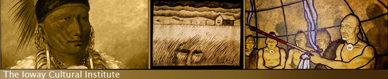
IOWA. (DAVID TOHEE) PICTURE HERE
In 1824 they ceded all their lands in Missouri, and in 1836 were assigned
a reservation in N. E. Kansas, from which a part of the tribe moved later to
another tract in central Oklahoma, which by agreement in 1890 was allotted
to them in severalty, the surplus acreage being opened to settlement by
whites.
Various estimates of the population of the Iowa at different dates are as
follows: In 1760, 1,100 souls; by Lewis and Clark in 1804, 800, smallpox
having carried off 100 men besides women and children in 1803; the Secretary
of War gives the number in 1829 as 1,000; Catlin in 1832 at about 1,400, but
in 1836 at 992; the Indian Affairs Report of 1843 gives their number as 470;
the number at the Potawatomi and Great Neinaha agency in Kansas was 143 in
1884, 138 in 1885, 143 in 1886, and 225 in 1905. At the latter date they
were under the jurisdiction of the Kickapoo School. At the Sauk and Fox
agency, Okla., in 1885 they numbered 88; in 1901, 88; in 1905, 89.
The Iowa camp circle was divided into half circles, occupied by two
phratries [half-division of the tribe] of four gentes [patrilineal clans]
each. These were:
First phratry. (1) Tunanpin, Black Bear; (2) Michirache, Wolf; (3)
Cheghita, Eagle and Thunder-being; (4) Khotachi, Elk.
Second phratry. (5) Pakhtha, Beaver; (6) Ruche, Pigeon; (7) Arukhwa,
Buffalo; (8) Wakan, Snake; (9) Mankoke, Owl. The last-named gens is
extinct.
There was an Iowa village called Wolf village. [This was the Iowas' first
village on the Wolf River in Kansas.]
See Catlin, Iowa Inds., 1844; Dorsey (1) in 11th. Rep. B. A. E., 1894,
and 15th Rep. Wash., II, 1883; Hamilton and Irvin, Ioway Gram., 1848;
Hayden, Ethnog. And Philol. Mo. Val., 1862; Lewis and Clark, Orig. Jour.,
I-VIII, 1904-05; Long, Exped. Rocky Mts., I, 1823; Minn. Hist. Soc. Coll.,
I, 1872; Sen. Doc. 452, 57th Cong., Ist sess., II, 1903. (J. O. D. .. C.
T.)
[In the original a list is given of alternate names of the Ioway
throughout history, not reproduced here. It may be transcribed at a later
date.] Return to top
Return to Ioway Virtual Library main page
|